| Description:
I was unable to view this track myself, so the following notes come from a
very reliable source...sorta reliable. Well, kinda reliable...actually it
may be a complete lie, but read on anyway...it's all we got
;-) Soil: Sand is the
word. Possibly red. And a rock or two around the hills.
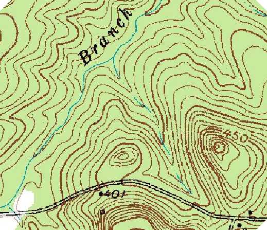
Elevation: I
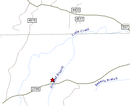
understand that the name of this place is Cox "MOUNTAIN"...go
figure. Look at the topo map below.
Dust:
Looks like there wont be that much dust if the rain keeps up.
Spectator Rating: See
Notes Below
Camping / Parking rating: See
Notes below
Normal Hours of Operation / Fees: The
usual fees apply for a race, but as far as I know, there aren't any open
times for general riding, other than the race date.
NOTES: As I have not seen the area
myself, I thought I would just give you the report that I got on this one.
You can thank your Asst. Track Super, Bubba Anders, for this one.
(thanks Bubba)
This is a technical track with lots of hills and lots of tight stuff .
At yesterdays testing , there were very few places to pass. It has a big open field for a good
start and will have a left turn to send you into the woods only to have a
dry creek crossing in less than a half of mile. The track has many many
twist and turns with a lot of hills and off camber turns at the top.
There is a log to jump and many small ones laying across the track. The
soil is sandy in most parts but there is a section of rock going up small
hills.
We have wet areas and a G-out creek crossing ( which is gonna be a bummer
) after practice ends. There are sections that are gonna get grooved real
quick . My tire will be the 756 ft & rear. It has my vote for track of
the year !!
It was real fun. Camping will be ok but there is not much level land . It
is rolling hills and is a very pretty place. it is about 10 miles from the
old Pittsburg track . Track length, around eight miles, give or take some mud detours.
Click Here for area weather from The
Weather Channel
|