Reconnaissance Photographs
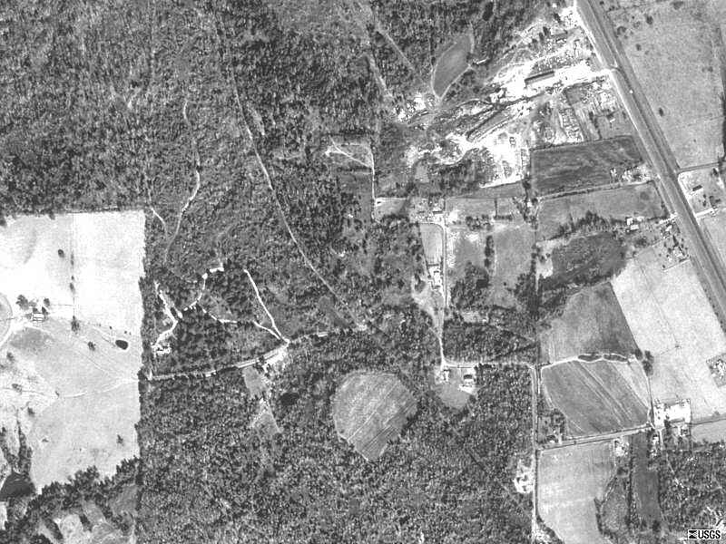
Ok this is a picture of the park area, that road on the upper right corner is Hwy 69.
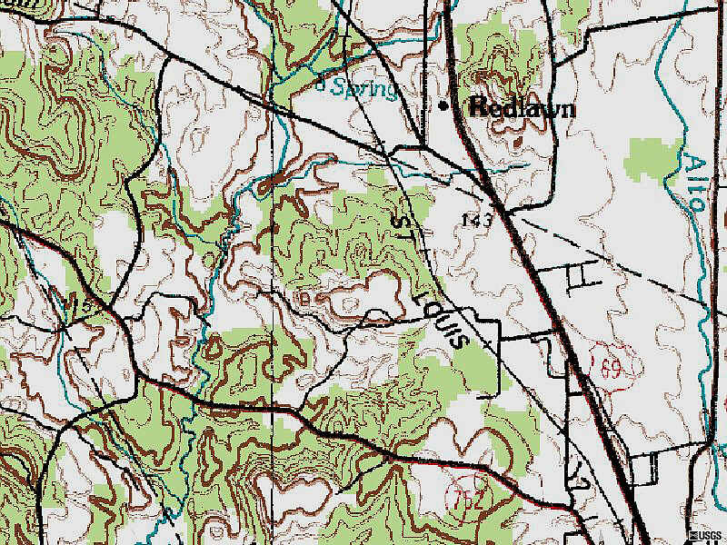
And for those of you into it, here's the topo...Rick.
|
Shiloh Ridge...Alto. |
|
How to get there |
||
|
Alright. Here's how I got there. From Dallas, I take 175 south / east. Keep goin' on through Gun Barrel City, on through Athens, down to Jacksonville. Continue to follow 175 through Jacksonville, but pay attention and follow the signs for 175. As you get into town 175 makes a kind of sharp right turn into downtown, and heads straight on through town. After you turn south, Hwy 69 is about three blocks east ( to your left ) and runs parallel to 175. So you can cross over on Lincoln St, or Lawrence St, or Pine or Woodrow...whatever make a left somewhere, get over to 69 South. Or wait till you get down to where 175 ends at 79 & turn left there to get over to 69 south. Then take 69 south on through Rusk, then about 9 miles ( maybe a little more ) to CR 2416. There's a Step van with a big arrow on it...turn right there. Follow the road 'till it comes to a Tee. Turn right & that road will dead end into the gate. Click Here for a Mapquest Map. Don't forget. You can zoom in on the map, & print it as you see fit. |
||
|
Track conditions, gearing, tires, etc. |
||
| Description:
Well, once again my track research doesn't include an actual lap on the
track, but I did meet & talk with Donnie about his track, and of
course my good friend, and fellow track official, Bubba Anders, helped
with this report. Apparently the track is gonna have a bit more
"woods sections than we may be used too. The good news is, that it
won't be so tight as to be classified as an Enduro Loop. Seriously, Donnie
assures me that there are plenty of straights, & passing areas. Many people have
said "this is a fun place to ride" and the facilities may
be civilized as well. Depending on what you're used too. I
kinda like the area myself. And this place is also a riding park as
I understand it. Donnie says the track is right at eight miles. He
also says there is a snow cone stand there, a hamburger stand, and
nice camping. Oh yeah, he also says that they'll have bags of ice for sale
if needs be.
Soil: I was riding at Thunder Mountain on Sunday ( 15 mi. north of Alto ), & though pretty densely foliated, it was a decent change of pace, though the sand remains the same... it's more red here in the east. I might use a sand tire, and if I were on a 125, I may gear down just a notch...or at least bring it along. Elevation: This one's actually got some ups & downs to it. In fact the whole area isn't nearly as flat as what we've been riding. I understand that there is one downhill in particular, that will ..."tighten & firm your buttocks" In fact there has been rumor of an uphill grassy start. Dust: I might as well take this category out. Unless it rains there will be dust. Maybe not as much as Bryson. But the entrance area will probably have a water truck standing by to help in keeping the dust down. Spectator Rating: As this is a Park ( Normally open to the public ), there should be plenty of access to the track for spectators. Camping / Parking rating: The camping area is, again, in an ORV park, so facilities are available, and the area is flat enough with some trees around the outside edges of the field. Donnie says there is grass. Bring your insect repellant. Normal Hours of Operation / Fees: Well these folks have a web site of their own, so click here to zip over & check it out ! Weather Click the link below for area weather. Check the forecast. Check the radar map. Click Here for area weather from The Weather Channel
|
|
Reconnaissance Photographs |
||
|
Ok this is a picture of the park area, that road on the upper right corner is Hwy 69.
And for those of you into it, here's the topo...Rick.
|
||
| I haven't researched hotels in the area, but there should be plenty around Jacksonville or Alto. |